
Staunton Neighbors Through Parcel Records
Public sources around a Staunton address describe land, activity, and historical context in different ways. A parcel layer supplies geometry, the assessor supplies tax fields one PID at a time, and a deed supplies recorded parties and legal description. Historic maps and directory street sections may help with an earlier block, while public planning documents can identify a community project. None of these sources is a present-day household roster. A current tax owner, in particular, is not automatically a resident.
| Source | What it shows about a block | Access |
|---|---|---|
| ArcGIS tax parcels | Geometry, parcel boundaries, adjoining parcels, and map context | Public REST and gallery reference, not a survey |
| City assessor | Tax fields and owner-of-record for an individual PID | Search each parcel; live controls need verification |
| Sanborn maps | Historic footprint, use, and construction notation | Historic Staunton Foundation and archival route |
| Directory street section | Occupants or businesses at its publication date | Library or historical-society research |
| Permits and inspections | Address-linked building activity | Civic Access or a defined city request |
| Deeds | Recorded ownership changes and legal descriptions | Clerk, SRA, or Library of Virginia microfilm |
| Voter lookup | One person's status after a match | Not a block browse; access is restricted |
| Public community records | Planning area or organization reference when published | Official plans and meeting records, with no complete directory found |
Start with the source that matches the question. A sidewalk question calls for parcel geometry. An ownership question calls for the assessor and, when needed, a deed. A historic-place question may call for a Sanborn sheet and a directory page from the same period. Keep the source date beside each field because parcels, owners, and planning records change independently.
Map Staunton Neighbors by Parcel
The City of Staunton's ArcGIS tax-parcel query is the starting point for a block map. Select the target parcel, inspect its boundary and labels, and identify the PIDs that actually touch it. A neighboring shape might be a rear lot, alley, public right-of-way, utility parcel, park, cemetery, condominium unit, or another property with the same owner. The parcel layer is public general-reference data, not a boundary survey.
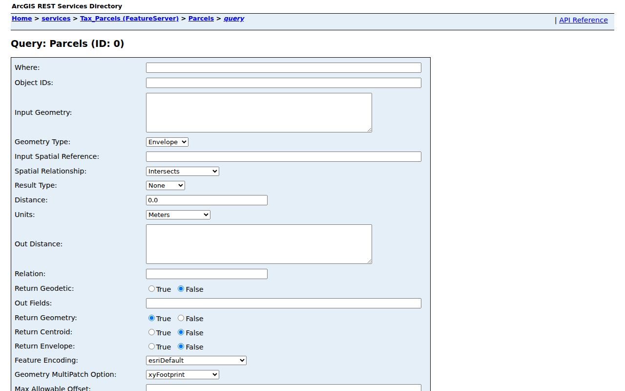
The query view is a record-research aid, not a visual promise that every object touching a line is a social neighbor. Compare the feature date and the map scale before relying on a relationship suggested by the display.
Use a consistent snapshot for each address: target address, inspection date, target PID, touching PID list, situs, legal description, source date, street-facing direction, and map scale. That record can be compared after a parcel split or GIS refresh without turning map labels into claims about occupants.
Touching Parcels Are Not Staunton Neighbors
Parcel adjacency is geometry only. A tax polygon can touch the target along a rear edge even when the house faces another street. An alley, creek, railroad line, or non-taxable strip may separate properties that look adjacent on a basemap. A small urban block can also contain a historic rear building or an earlier larger tract hidden by a current street number. Check frontage, rear access, and the assessor legal description before describing two parcels as next door.
Open the Staunton tax-parcels REST service for the layer metadata and parcel-query entry point.
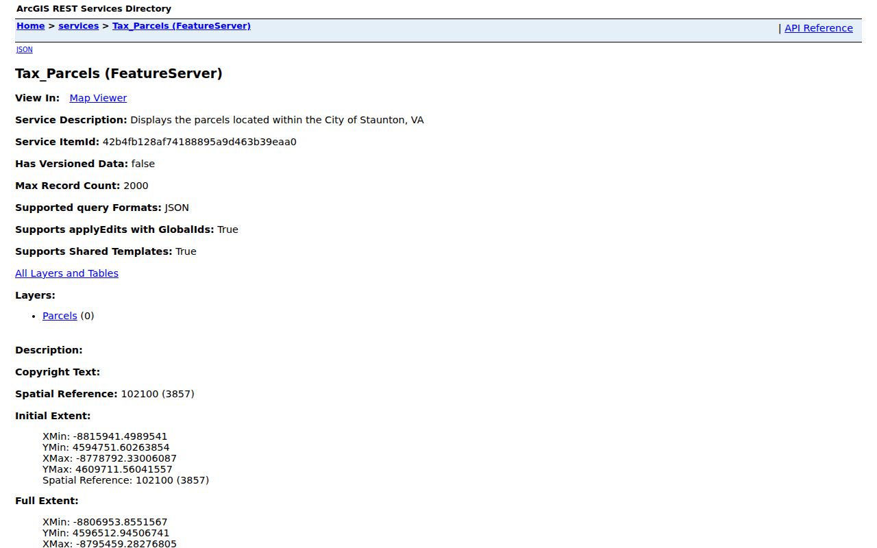
The service describes local tax parcels and query parameters, including geometry options and a maximum record count of 2,000. It does not replace a plat, a surveyed boundary, or the latest recorded deed.
Check Staunton Neighbors One PID at a Time
After the map identifies the touching parcels, the next task is a separate record review for each PID. Do not treat a single owner search or a shared mailing label as evidence that a group of parcels forms one household. The Staunton assessor database is the local tax source, while the circuit clerk's land-record route can resolve a conveyance or legal-description question.
- Locate the target address and note its PID, source date, situs, and legal description.
- Inspect parcel geometry and make a list only of PIDs that touch the target after checking for intervening strips or access ways.
- Open the assessor record for each touching PID separately. Record the owner-of-record, situs, legal description, assessed date, and tax year.
- Keep mailing details out of a block summary. A tax mailing destination may be an agent, PO box, trust, or other correspondence point.
- Use a deed or permit only when it answers a defined ownership or building-activity question, then preserve the document date and locator.
For a longer chain along a named street, move to the Staunton Street Directory. That address-focused route is better suited to a full street than a block snapshot.
Staunton Neighbors and Tax Ownership
The assessor makes a parcel legible through fields such as PID, situs, owner or co-owner, legal description, subdivision, mailing address, map or tracing, and assessed values. For a block question, preserve the PID, situs, owner-of-record, parcel geometry, tax year, and source date. The city labels its assessor information as informational and not legal evidence by itself. A feature-service date is also not necessarily the date of the latest deed or tax change.
Current tax ownership is not proof that the named party lives there. The owner can be a municipality, church, company, utility, trust, estate, or a person with a different residence. The mailing address may be outside the city, and it should not be published merely because a portal displays it. When a deed and a directory disagree, the records may be describing different roles, such as an owner and an occupant.
Note: Preserve the legal description and document date when a parcel number or street number seems to change across sources.
Staunton Neighborhoods in Public Plans
Public planning material supplies a community layer without creating a private membership directory. Official comprehensive-plan material names the Newtown Neighborhood Association and the Newtown Center Business Guild. Uniontown has an official neighborhood plan and steering-process record. Those references can help identify a public project area or meeting context, but no complete current official association directory was located.
| Publicly named organization or area | Public record layer | What it does not establish |
|---|---|---|
| Newtown Neighborhood Association | Named in official comprehensive-plan material | A complete member list, personal contacts, or an exact private boundary |
| Newtown Center Business Guild | Named in official planning material | A resident roster or private member directory |
| Uniontown | Official plan and steering-process record; historic community and active planning context | Membership, parcel occupancy, or a final title conclusion |
Use the official comprehensive-plan material, public meeting packets, the planning office, library local-history files, Historic Staunton Foundation, or the Augusta County Historical Society when a public boundary or project needs context. Avoid scraped social-network lists and do not invent association contacts.
Staunton Neighbors in Permits and Deeds
Permits can explain construction or inspection activity at a block address, but they do not create a roster of people who live nearby. Staunton's Civic Access information describes the current online permitting and licensing route. The city states that permits dated before May 5, 2026 are not available online. For that earlier gap, use Community Development, the relevant city office, or a defined Virginia FOIA request rather than treating the current portal as a complete archive.
Deeds are secondary block context when a title change or legal description matters. The Virginia SRA land-record system is the current land-record access route, while older books and indexes may require the clerk or Library of Virginia microfilm. A recorded party can be a trustee, executor, company, or estate. It is a conveyance fact, not a resident identity.
Voter Limits for Staunton Neighbors
The Virginia voter lookup takes a first name, last name, date of birth, and ZIP to return a matched voter-information view. It cannot browse a block or street. Individual VERIS records are restricted under Virginia Code §24.2-404, and the categories and purposes for voter-list access are limited by §24.2-405. A public map, ZIP, or street name does not override those limits.
| Source category | Useful block question | Important limit |
|---|---|---|
| Official parcel, deed, permit, or planning record | Parcel geometry, recorded ownership, building activity, or public project context | Each record has its own date, purpose, and custodian; it does not prove a household |
| Commercial people-search category | May claim to assemble names and addresses from mixed sources | Data can be inaccurate or out of date and should not replace a custodian record or privacy safeguards |
The lawful approach is narrow: verify the record needed for a personal, family-history, safety, or civic question, then stop. Do not infer voting behavior, a full household, or a private address from a match.
City Lines Around Staunton Neighbors
Staunton is an independent city beside Augusta County, a separate local government and record jurisdiction. A nearby Augusta parcel can share a Staunton mailing city, ZIP, newspaper reference, or visual map area. That does not make it a city parcel. Before researching a bordering block, confirm the physical parcel's jurisdiction, then use the appropriate assessor, clerk, and planning office.
The city and county distinction is especially important for an address that appears close to an edge. Postal geography answers delivery questions. Parcel jurisdiction determines the government record trail. If a city map and a mailing label pull in different directions, retain both facts and ask the applicable custodian which parcel record controls.
Historic Staunton Neighbors by Date
A historic block needs a date-specific method. Put a Sanborn sheet beside a directory street page and current GIS geometry, then compare the building footprint, street order, and address. Sanborn maps can show use, materials, and adjacent structures, but an unlabeled footprint cannot name an occupant. City-directory street order may also differ from the present block order, so preserve the publication year and page.
When a historical directory and deed point to different names, record the likely roles and seek a third source such as a newspaper notice, tax record, or map. Historic research can explain how a block changed without asserting who is present now. The library and historical collections are more appropriate than an attempt to recreate a current neighborhood roster.
Privacy Limits for Staunton Neighbors
Keep sensitive details out of a block record. Virginia's Address Confidentiality Program under §2.2-515.2 offers qualifying victims a substitute mailing address. Sealed, expunged, juvenile, protected-health, DMV, adoption, and protected-voter information have separate limits. A public-record request does not override those protections.
Repeated conduct that causes a person to fear death, sexual assault, or bodily injury can violate Virginia's anti-stalking law, §18.2-60.3. Preserve only the information needed for the legitimate record question, use the custodian for confirmation, and seek emergency help through 911 when there is an immediate threat.